


voie douce la ciotat

ego
User

Length
10.5 km

Max alt
88 m

Uphill gradient
147 m
Km-Effort
12.4 km

Min alt
-1 m

Downhill gradient
154 m
Boucle
No
Creation date :
2022-10-15 14:19:01.562
Updated on :
2022-10-15 15:34:49.864
1h07
Difficulty : Easy

FREE GPS app for hiking
 SityTrail
IGN / Geographical institutes
SityTrail Plus
The world is yours!
About
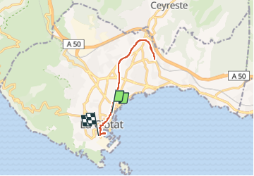
Trail Road bike of 10.5 km to be discovered at Provence-Alpes-Côte d'Azur, Bouches-du-Rhône, La Ciotat. This trail is proposed by ego .
Description
sur le tracé de l'ancienne voie de chemin de fer ,qui reliait le chantier naval à la ligne sncf.
Positioning
Country:
France
Region :
Provence-Alpes-Côte d'Azur
Department/Province :
Bouches-du-Rhône
Municipality :
La Ciotat
Location:
Unknown
Start:(Dec)
Start:(UTM)
712228 ; 4784121 (31T) N.
Comments